
Plate Tectonics: A Visual Explainer
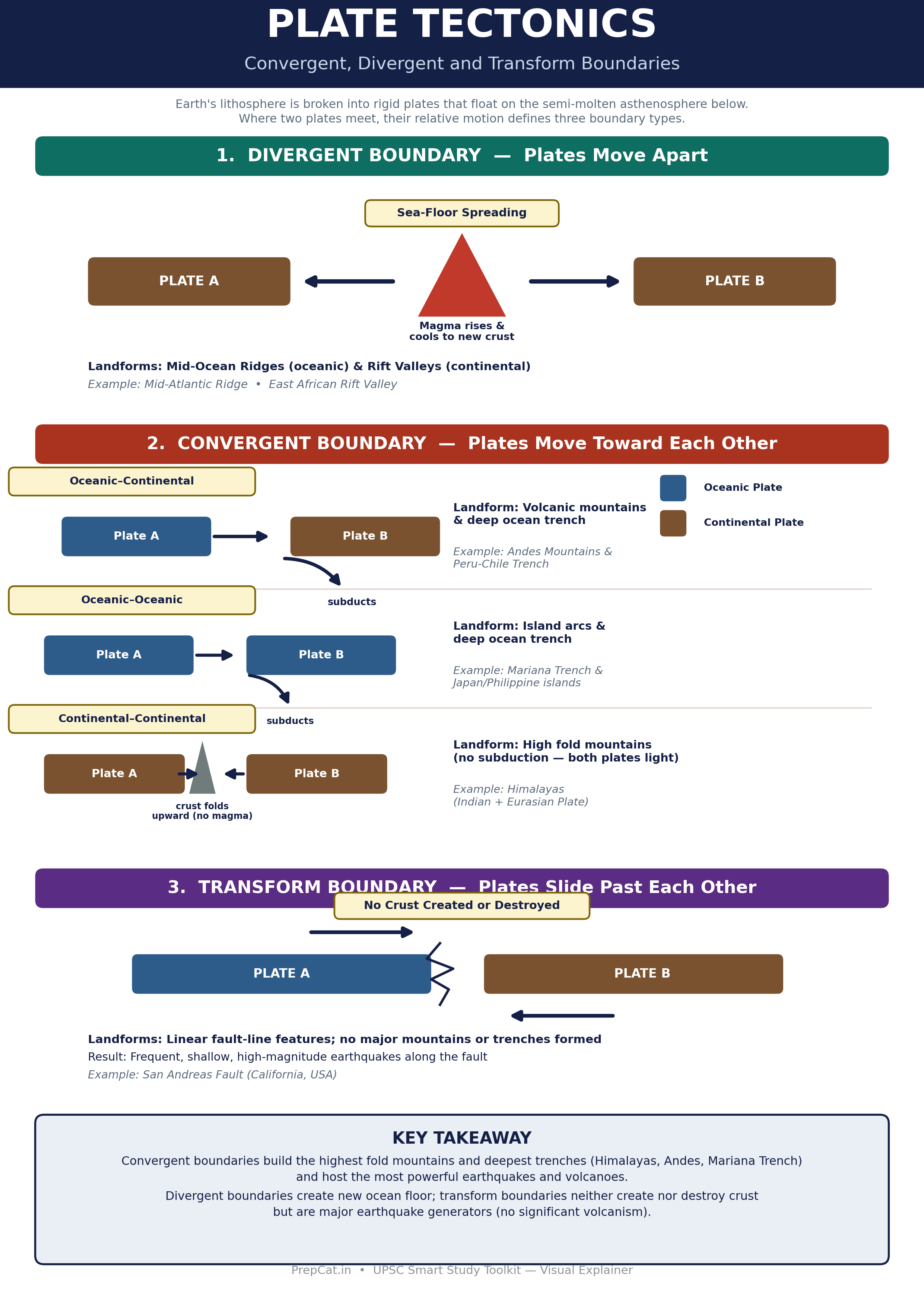
A single infographic mapping the three plate boundary types — divergent, convergent (all three sub-types) and transform — with the landforms and real-world examples each produces.
📌 Revision Pointers
Divergent: plates move apart, magma rises to form new crust — Mid-Ocean Ridges & Rift Valleys (e.g. Mid-Atlantic Ridge, East African Rift Valley).
Convergent: plates collide — Oceanic–Continental and Oceanic–Oceanic sub-types involve subduction, producing volcanic mountains/island arcs and deep trenches (Andes, Mariana Trench); Continental–Continental involves no subduction and produces high fold mountains (Himalayas).
Transform: plates slide past each other, no crust created or destroyed — only fault-line earthquakes, no major landforms (San Andreas Fault).
One clean labeled diagram showing how divergent, convergent and transform plate boundaries differ in plate motion, resulting landforms and hazards.
💭 Conclusion
A high-yield Geography diagram for UPSC: boundary type ↔ landform ↔ example matching (e.g. Himalayas from continental–continental convergence) is a recurring Prelims trap.